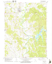
1979 Map of Novinger
USGS Topo · Published 1979About this map
Novinger serves as the primary hub of this Adair County landscape, where the Chariton River winds southward past industrial and recreational grounds. The map reveals an area defined by its extraction history and evolving infrastructure, marked by numerous unlabeled Mine sites and Sandpits that dot the river valley. The corridor of the Old Railroad Grade follows the river's western bank, passing the smaller settlements of Tipperary and Youngstown. To the east, the creation of Thousand Hills State Park Lake has transformed the terrain into a center for recreation, featuring a Boat Ramp and several Campgrounds. Genealogists will find a wealth of burial sites, from the larger Novinger Cem to smaller family landmarks like Parcell Salisbury Cem and Lutz Cem, alongside rural landmarks such as Bear Creek Ch.
Find a feature on this map
44 named features on this map. Tap any name to fly to it.
Don’t see what you’re looking for? This feature index may not catch every label — zoom into the map to look around manually.
Map Details
Editions of this 1979 Novinger Map
This is the sole edition of this map. No revisions or reprints were ever made.
Other maps of this area

1911 · Queen City
USGS Topo · 1:62,500

1912 · Green City
USGS Topo · 1:62,500

1913 · Queen City
USGS Topo · 1:62,500

1914 · Green City
USGS Topo · 1:62,500

1938 · Kirksville
USGS Topo · 1:62,500

1940 · Kirksville
USGS Topo · 1:62,500

1954 · Centerville
USGS Topo · 1:250,000

1957 · Centerville
USGS Topo · 1:250,000

1958 · Centerville
USGS Topo · 1:250,000

1963 · Pure Air
USGS Topo · 1:24,000