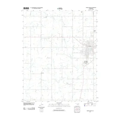
2010 Map of Nowata West
USGS Topo · Published 2010About this map
Nowata serves as the central hub of this northeastern Oklahoma landscape, situated where the grid of city streets meets the surrounding agricultural plains. The town's infrastructure includes the Nowata Municipal Airport and Memorial Park Cemetery, while the broader terrain is defined by a dense network of sectional roads and the winding paths of local waterways. The Western Branch Verdigris River skirts the eastern edge of the community, while the South Fork Double Creek and North Fork Double Creek drain the rural sections to the west.
Find a feature on this map
37 named features on this map. Tap any name to fly to it.
Don’t see what you’re looking for? This feature index may not catch every label — zoom into the map to look around manually.
Map Details
Editions of this 2010 Nowata West Map
This is the sole edition of this map. No revisions or reprints were ever made.
Other maps of this area

1901 · Nowata
USGS Topo · 1:125,000

1914 · Nowata
USGS Topo · 1:125,000

1954 · Tulsa
USGS Topo · 1:250,000

1958 · Tulsa
USGS Topo · 1:250,000

1963 · Tulsa
USGS Topo · 1:250,000

1970 · Bartlesville SE
USGS Topo · 1:24,000
1970 · Talala
USGS Topo · 1:24,000
1970 · Winganon
USGS Topo · 1:24,000

1972 · Blue Mound
USGS Topo · 1:24,000

1972 · Nowata West
USGS Topo · 1:24,000