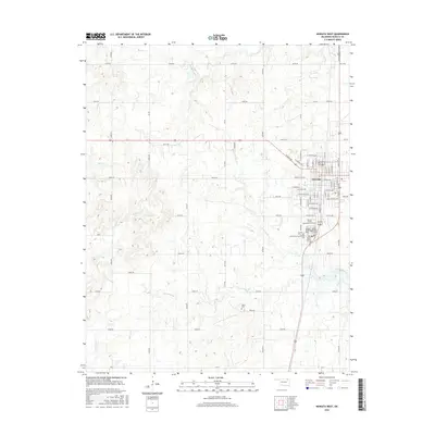
2016 Map of Nowata West
USGS Topo · Published 2016About this map
Nowata serves as the focal point for this 2016 survey, where the town's western outskirts meet a landscape defined by meandering creek beds and concentrated history. The area south of the main settlement is particularly significant for genealogists, as it contains a dense cluster of burial sites known as the Nowata Relocated Cemeteries. This group includes the Lincoln Cem, Armstrong-Journeycake Cem, and two sites identified as Family Number 12 Cem and Family Number 13 Cem.
Find a feature on this map
81 named features on this map. Tap any name to fly to it.
Don’t see what you’re looking for? This feature index may not catch every label — zoom into the map to look around manually.
Map Details
Editions of this 2016 Nowata West Map
This is the sole edition of this map. No revisions or reprints were ever made.
Other maps of this area

1901 · Nowata
USGS Topo · 1:125,000

1914 · Nowata
USGS Topo · 1:125,000

1954 · Tulsa
USGS Topo · 1:250,000

1958 · Tulsa
USGS Topo · 1:250,000

1963 · Tulsa
USGS Topo · 1:250,000

1970 · Bartlesville SE
USGS Topo · 1:24,000
1970 · Talala
USGS Topo · 1:24,000
1970 · Winganon
USGS Topo · 1:24,000

1972 · Blue Mound
USGS Topo · 1:24,000

1972 · Nowata West
USGS Topo · 1:24,000