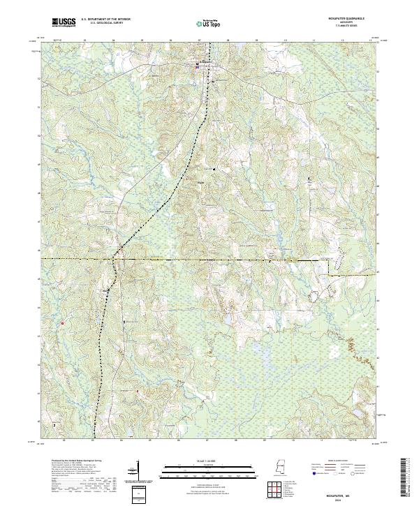
2024 Map of Noxapater
USGS Topo · Published 2024About this map
Noxapater serves as the primary settlement on this sheet, situated at the junction of W Main St and S Money St. The surrounding landscape is defined by the headwaters of the Pearl River, with the Bogue Chitto and Noxapater Creek winding through the timbered terrain. This area, straddling the border between Winston and Neshoba Counties, contains several family and community landmarks, including Hight and the rail-aligned community of Stallo. Genealogists will find a high density of rural burial grounds, such as Methodist Cem, Mount Pisgah Cem, and Union Ridge Cem, which provide historical anchors for the local townships. The road network, comprising named routes like Barrier Clay Rd and Union Ridge Rd, reflects a history of small-scale agriculture and forest access throughout the mid-20th century into the modern era.
Find a feature on this map
87 named features on this map. Tap any name to fly to it.
Don’t see what you’re looking for? This feature index may not catch every label — zoom into the map to look around manually.
Map Details
Editions of this 2024 Noxapater Map
This is the sole edition of this map. No revisions or reprints were ever made.
Other maps of this area

1953 · Meridian
USGS Topo · 1:250,000

1953 · West Point
USGS Topo · 1:250,000

1957 · Meridian
USGS Topo · 1:250,000

1958 · West Point
USGS Topo · 1:250,000

1962 · Vernon
USGS Topo · 1:24,000

1962 · Owl Creek
USGS Topo · 1:24,000

1963 · West Point
USGS Topo · 1:250,000

1965 · Meridian
USGS Topo · 1:250,000

1972 · Pearl River
USGS Topo · 1:24,000

1972 · Plattsburg
USGS Topo · 1:24,000