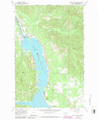
1966 Map of Noxon Rapids Dam
USGS Topo · Published 1984About this map
The Noxon Rapids Dam anchors this mid-century landscape, where the Clark Fork transitions into the expansive Noxon Reservoir. This survey captures the infrastructure and topography of the Kaniksu National Forest during the height of the Cold War era. The reservoir, with its normal pool elevation of 2331 feet, submerged much of the original river valley, creating new landmarks like Rock Island and reshaping the shoreline near Marten Creek Bay.
Find a feature on this map
29 named features on this map. Tap any name to fly to it.
Don’t see what you’re looking for? This feature index may not catch every label — zoom into the map to look around manually.
Map Details
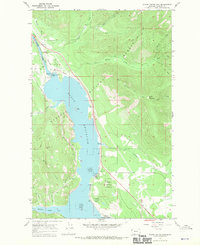
Editions of this 1966 Noxon Rapids Dam Map
2 editions found
Other maps of this area

1920 · Libby
USGS Topo · 1:125,000

1930 · Libby
USGS Topo · 1:125,000

1932 · Libby
USGS Topo · 1:125,000

1932 · Trout Creek
USGS Topo · 1:125,000

1935 · Trout Creek
USGS Topo · 1:125,000

1936 · Trout Creek
USGS Topo · 1:125,000

1956 · Wallace
USGS Topo · 1:250,000

1957 · Kalispell
USGS Topo · 1:250,000

1960 · Kalispell
USGS Topo · 1:250,000

1960 · Wallace
USGS Topo · 1:250,000