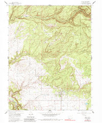
1960 Map of Nucla
USGS Topo · Published 1985About this map
Nucla serves as the primary hub of this high-desert landscape in the early 1960s, situated near the San Miguel River and south of the rugged Uncompahgre National Forest boundary. The town center is clearly defined by local infrastructure including the High Sch and the nearby Town Reservoir. The surrounding terrain is a complex system of plateaus and canyons, including the family-named Templeton Ranch along the winding Tabeguache Creek.
Find a feature on this map
26 named features on this map. Tap any name to fly to it.
Don’t see what you’re looking for? This feature index may not catch every label — zoom into the map to look around manually.
Map Details
Editions of this 1960 Nucla Map
3 editions found
Other maps of this area

1916 · Paradox Valley
USGS Topo · 1:125,000

1922 · Paradox Valley
USGS Topo · 1:125,000

1948 · Uravan
USGS Topo · 1:24,000

1948 · Naturita NW
USGS Topo · 1:24,000

1949 · Uravan
USGS Topo · 1:24,000

1949 · Naturita NW
USGS Topo · 1:24,000

1949 · Atkinson Creek
USGS Topo · 1:24,000

1950 · Atkinson Creek
USGS Topo · 1:24,000

1956 · Moab
USGS Topo · 1:250,000

1959 · Moab
USGS Topo · 1:250,000