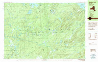
1989 Map of Number Four
USGS Topo · Published 1989About this map
The Adirondack Park boundary encompasses a landscape of dense water networks and isolated peaks along the border of Lewis and Herkimer Counties. This 1989 survey reveals a transitional wilderness where the Independence River winds through Balsam Flats, set against the elevation of Stillwater Mountain and Mount Tom. The map captures the hydrological complexity of the North Country, featuring the sprawling Stillwater Reservoir and the hydraulic power of Moshier Falls.
Find a feature on this map
52 named features on this map. Tap any name to fly to it.
Don’t see what you’re looking for? This feature index may not catch every label — zoom into the map to look around manually.
Map Details
Editions of this 1989 Number Four Map
2 editions found
Other maps of this area

1901 · Old Forge
USGS Topo · 1:62,500

1903 · Big Moose
USGS Topo · 1:62,500

1905 · Port Leyden
USGS Topo · 1:62,500

1907 · Port Leyden
USGS Topo · 1:62,500

1911 · Lowville
USGS Topo · 1:62,500

1912 · Number Four
USGS Topo · 1:62,500

1912 · Mc Keever
USGS Topo · 1:62,500

1913 · Lowville
USGS Topo · 1:62,500

1915 · Number Four
USGS Topo · 1:62,500

1940 · Port Leyden
USGS Topo · 1:62,500