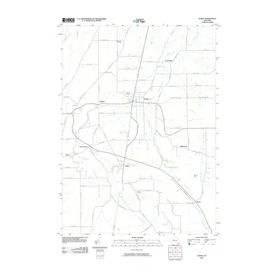
2010 Map of Nunda
USGS Topo · Published 2010About this map
Keshequa Creek and its many tributaries, including Newville Creek, carve through the landscape of the Genesee Valley region, defining the settlement patterns of this part of Livingston County. The village of Nunda sits at a central crossroads, surrounded by smaller hamlets like Oakland, Coopersville, and Hunt Hollow. This survey preserves the local geography of the early 21st century, illustrating how the rural road network, including the Nunda Dalton Rd and Nunda-Byersville Rd, connects long-established farming communities and scattered residential pockets.
Find a feature on this map
77 named features on this map. Tap any name to fly to it.
Don’t see what you’re looking for? This feature index may not catch every label — zoom into the map to look around manually.
Map Details
Editions of this 2010 Nunda Map
This is the sole edition of this map. No revisions or reprints were ever made.
Other maps of this area

1905 · Portage
USGS Topo · 1:62,500

1905 · Nunda
USGS Topo · 1:62,500

1906 · Angelica
USGS Topo · 1:62,500

1916 · Canaseraga
USGS Topo · 1:62,500

1940 · Canaseraga
USGS Topo · 1:62,500

1941 · Angelica
USGS Topo · 1:62,500

1943 · Mount Morris
USGS Topo · 1:24,000

1943 · Sonyea
USGS Topo · 1:24,000

1943 · Nunda
USGS Topo · 1:24,000

1943 · Ossian
USGS Topo · 1:24,000