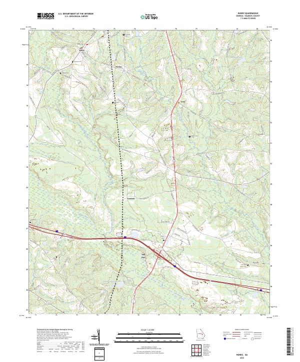
2024 Map of Nunez
USGS Topo · Published 2024About this map
Nunez and Oak Park anchor this Emanuel County landscape, where the southern reaches are defined by the winding course of the Ohoopee River. The map reveals a rural community structured around family heritage and agricultural lifelines, evident in the numerous family-named landmarks and cemeteries scattered across the terrain. From the northern settlement of Wesley down through Lexsy and Lombard, the land is a complex network of creeks like Yam Grandy Creek and Jacks Creek that feed into larger bodies such as Youmans Lake. For genealogists, the map is a primary resource, pinpointing several local burial grounds including Youmans Cem, Flatford Cem, and the Edenfield Slater Cem. The southern half shows the more recent intersection of major thoroughfares at Oak Park, contrasting with the legacy road names like Lexsy School Rd and Youmans Cemetery Rd that speak to the area’s longstanding community centers.
Find a feature on this map
81 named features on this map. Tap any name to fly to it.
Don’t see what you’re looking for? This feature index may not catch every label — zoom into the map to look around manually.
Map Details
Editions of this 2024 Nunez Map
This is the sole edition of this map. No revisions or reprints were ever made.
Other maps of this area

1957 · Macon
USGS Topo · 1:250,000

1958 · Macon
USGS Topo · 1:250,000

1964 · Macon
USGS Topo · 1:250,000

1970 · Cobbtown
USGS Topo · 1:24,000

1970 · Oak Park SW
USGS Topo · 1:24,000

1970 · Covena
USGS Topo · 1:24,000

1970 · Nunez
USGS Topo · 1:24,000

1970 · Oak Park
USGS Topo · 1:24,000

1971 · Norristown
USGS Topo · 1:24,000

1971 · Stillmore
USGS Topo · 1:24,000