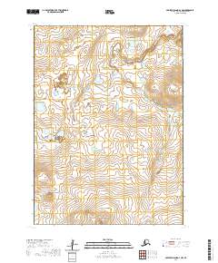
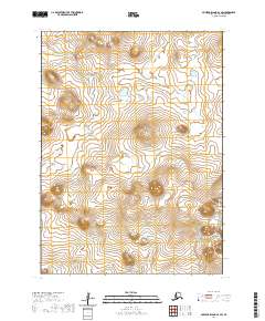
2020 Map of Nunivak Island A-4 NW
USGS Topo · Published 2020About this map
The Mekoryuk River and Kahniruk River drain a tundra landscape characterized by numerous small lakes and meandering waterways on Nunivak Island. This 2020 survey illustrates the hydrological complexity of the Bethel Census Area, where drainage features like Ninikmiut Cr and the Nariksmiut River carve through low-elevation terrain. Unlike the more mountainous regions of the mainland, the relief here is defined by subtle rises such as the Kimit Hills and the Ingrilukat Hills.
Find a feature on this map
12 named features on this map. Tap any name to fly to it.
Don’t see what you’re looking for? This feature index may not catch every label — zoom into the map to look around manually.
Map Details
Editions of this 2020 Nunivak Island A-4 NW Map
This is the sole edition of this map. No revisions or reprints were ever made.
Other maps of this area

1951 · Nunivak Island
USGS Topo · 1:250,000

1952 · Nunivak Island A-4
USGS Topo · 1:63,360

1952 · Nunivak Island A-5
USGS Topo · 1:63,360
1952 · Nunivak Island B-5
USGS Topo · 1:63,360
1952 · Nunivak Island B-4
USGS Topo · 1:63,360

1954 · Nunivak Island
USGS Topo · 1:250,000

1958 · Nunivak Island
USGS Topo · 1:250,000

1964 · Nunivak Island
USGS Topo · 1:250,000
2020 · Nunivak Island A-4 SE
USGS Topo · 1:25,000
2020 · Nunivak Island A-4 SW
USGS Topo · 1:25,000