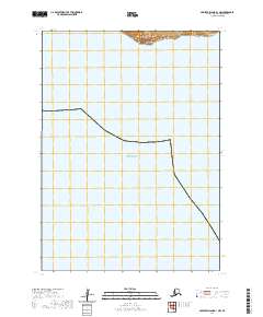
2020 Map of Nunivak Island B-1 NW
USGS Topo · Published 2020About this map
Umkumiute sits on the northern coastline of this remote Bering Sea outpost, representing the primary settlement focus within this maritime landscape. Most of the quadrangle is defined by the open waters of the Bering Sea and the Etolin Strait, which separates Nunivak Island from the Alaskan mainland. The terrestrial portion of the map is concentrated in the northern section, where the land rises at Atrnak Point. These landforms, identified under the t5n r91w and t5n r92w townships, illustrate the stark contrast between the island's interior elevations and the surrounding coastal waters. The cartography emphasizes the isolated nature of the island's northern shore, providing a precise record of the topography and shoreline as they appeared in 2020.
Find a feature on this map
6 named features on this map. Tap any name to fly to it.
Don’t see what you’re looking for? This feature index may not catch every label — zoom into the map to look around manually.
Map Details
Editions of this 2020 Nunivak Island B-1 NW Map
This is the sole edition of this map. No revisions or reprints were ever made.
Other maps of this area

1951 · Nunivak Island
USGS Topo · 1:250,000
1952 · Nunivak Island B-2
USGS Topo · 1:63,360

1954 · Nunivak Island
USGS Topo · 1:250,000

1954 · Nunivak Island B-1
USGS Topo · 1:63,360

1954 · Nunivak Island C-1
USGS Topo · 1:63,360

1958 · Nunivak Island
USGS Topo · 1:250,000

1964 · Nunivak Island
USGS Topo · 1:250,000
2020 · Nunivak Island C-1 OE W SE
USGS Topo · 1:25,000
2020 · Nunivak Island B-1 NE
USGS Topo · 1:25,000

2020 · Nunivak Island C-1 SE
USGS Topo · 1:25,000