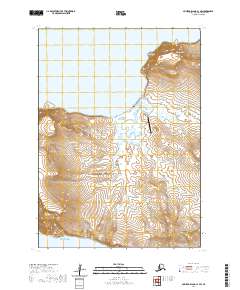
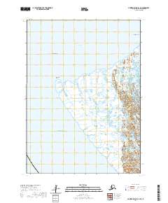
2020 Map of Nunivak Island C-1 SW
USGS Topo · Published 2020About this map
Tununak serves as the primary coastal settlement on this portion of Nelson Island, situated where the Tununak River meets the waters of Tununak Bay. The landscape is defined by its maritime orientation, with the settlement connected to the Tununak Airport via a network of local roads including Allaq Road and Tununak Landing Strip Road. The terrain rises significantly from the coast toward the volcanic peaks of Ugchirnak Mtn in the northeast and Kitnik Mtn to the south. Along the Bering Sea coastline, prominent landmarks such as Chinit Point and Uluruk Point define the rugged shoreline. This survey captures the modern infrastructure of the village, illustrating the intersection of traditional land use and essential transport facilities like the Landfill Road and the N Fork Tununak River drainage system.
Find a feature on this map
20 named features on this map. Tap any name to fly to it.
Don’t see what you’re looking for? This feature index may not catch every label — zoom into the map to look around manually.
Map Details
Editions of this 2020 Nunivak Island C-1 SW Map
This is the sole edition of this map. No revisions or reprints were ever made.
Other maps of this area

1951 · Nunivak Island
USGS Topo · 1:250,000
1952 · Nunivak Island B-2
USGS Topo · 1:63,360

1954 · Nunivak Island
USGS Topo · 1:250,000

1954 · Nunivak Island B-1
USGS Topo · 1:63,360

1954 · Nunivak Island C-1
USGS Topo · 1:63,360

1958 · Nunivak Island
USGS Topo · 1:250,000

1964 · Nunivak Island
USGS Topo · 1:250,000
2020 · Nunivak Island C-1 OE W SE
USGS Topo · 1:25,000
2020 · Nunivak Island C-1 NE
USGS Topo · 1:25,000
2020 · Nunivak Island B-1 NE
USGS Topo · 1:25,000