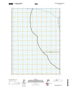
2020 Map of Nunivak Island D-1 NW
USGS Topo · Published 2020About this map
Hazen Bay dominates this coastal survey of western Alaska, where the landscape is defined by the shifting boundaries of the Kusilvak Census Area Bethel Census Area. The map represents a remote and fluid environment where the land meets the Bering Sea, captured here in its contemporary 2020 state. Because of the region's low-lying nature, the map displays the intricate boundary lines between these two vast administrative districts, which traverse the tidal zones and open water. The lack of named inland settlements or infrastructure highlights the preserved, wild character of this portion of the Yukon-Kuskokwim Delta, making it a critical reference for understanding the modern political and natural geography of this isolated coastline.
Find a feature on this map
5 named features on this map. Tap any name to fly to it.
Don’t see what you’re looking for? This feature index may not catch every label — zoom into the map to look around manually.
Map Details
Editions of this 2020 Nunivak Island D-1 NW Map
This is the sole edition of this map. No revisions or reprints were ever made.
Other maps of this area

1951 · Hooper Bay
USGS Topo · 1:250,000

1951 · Nunivak Island
USGS Topo · 1:250,000
1952 · Hooper Bay A-2
USGS Topo · 1:63,360

1953 · Hooper Bay
USGS Topo · 1:250,000

1954 · Nunivak Island
USGS Topo · 1:250,000
1954 · Hooper Bay A-1
USGS Topo · 1:63,360
1954 · Nunivak Island D-1
USGS Topo · 1:63,360

1958 · Nunivak Island
USGS Topo · 1:250,000

1964 · Nunivak Island
USGS Topo · 1:250,000

1964 · Hooper Bay
USGS Topo · 1:250,000