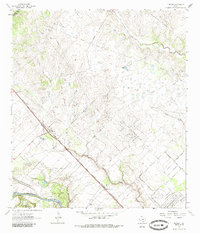
1963 Map of Nursery
USGS Topo · Published 1985About this map
The Guadalupe River winds across the southern reaches of this Victoria County landscape, providing a natural anchor for the surrounding agricultural and industrial activity. The Southern Pacific railroad serves as the primary corridor for the region, passing through the settlement of Nursery and the small station point of Moursund. The area is characterized by numerous Gravel Pit operations and a network of pipelines, indicating the local reliance on resource extraction during the early 1960s.
Find a feature on this map
23 named features on this map. Tap any name to fly to it.
Don’t see what you’re looking for? This feature index may not catch every label — zoom into the map to look around manually.
Map Details
Editions of this 1963 Nursery Map
3 editions found
Other maps of this area

1951 · Inez NW
USGS Topo · 1:24,000

1952 · Victoria East
USGS Topo · 1:24,000

1953 · Beeville
USGS Topo · 1:250,000

1953 · Seguin
USGS Topo · 1:250,000

1956 · Beeville
USGS Topo · 1:250,000

1958 · Seguin
USGS Topo · 1:250,000

1960 · Beeville
USGS Topo · 1:250,000

1962 · Verhelle
USGS Topo · 1:24,000

1963 · Fordtran
USGS Topo · 1:24,000

1963 · Nursery
USGS Topo · 1:24,000