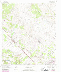
1963 Map of Nursery
USGS Topo · Published 1987About this map
The Guadalupe River meanders across the southern landscape of this coastal plain, anchoring a region defined by its transit corridors and rural crossroads in the early 1960s. The Southern Pacific railroad runs straight through the settlement of Nursery, providing a backbone for early industry as evidenced by the numerous Gravel Pits and gravel pits dotting the terrain. Further south, the community of Moursund sits near the riverbanks, while the periphery is marked by an Airfield (Abandoned) and the active Ball Airport, illustrating the shift from rail to air transport in the mid-20th century.
Find a feature on this map
25 named features on this map. Tap any name to fly to it.
Don’t see what you’re looking for? This feature index may not catch every label — zoom into the map to look around manually.
Map Details
Editions of this 1963 Nursery Map
3 editions found
Other maps of this area

1951 · Inez NW
USGS Topo · 1:24,000

1952 · Victoria East
USGS Topo · 1:24,000

1953 · Beeville
USGS Topo · 1:250,000

1953 · Seguin
USGS Topo · 1:250,000

1956 · Beeville
USGS Topo · 1:250,000

1958 · Seguin
USGS Topo · 1:250,000

1960 · Beeville
USGS Topo · 1:250,000

1962 · Verhelle
USGS Topo · 1:24,000

1963 · Fordtran
USGS Topo · 1:24,000

1963 · Nursery
USGS Topo · 1:24,000