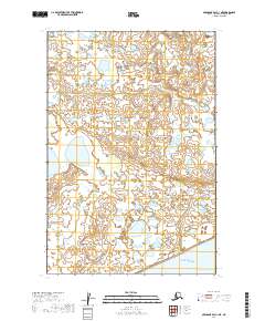
2019 Map of Nushagak Bay C-1 NE
USGS Topo · Published 2019About this map
Kvichak Bay defines the southern margin of this remote coastal landscape, where the waters of the Bristol Bay region meet an intricate system of wetlands and small lakes. The terrain is characterized by a high density of thaw lakes and ponds scattered across the low-lying tundra, a pattern typical of the Dillingham Census Area. This 2019 survey provides a precise look at the hydrography of the region just before the turn of the decade, showing the complex drainage patterns and seasonal water bodies that shape the environment.
Find a feature on this map
7 named features on this map. Tap any name to fly to it.
Don’t see what you’re looking for? This feature index may not catch every label — zoom into the map to look around manually.
Map Details
Editions of this 2019 Nushagak Bay C-1 NE Map
This is the sole edition of this map. No revisions or reprints were ever made.
Other maps of this area

1945 · Nushagak Bay
USGS Topo · 1:250,000

1949 · Nushagak Bay
USGS Topo · 1:250,000

1951 · Nushagak Bay
USGS Topo · 1:250,000

1952 · Naknek
USGS Topo · 1:250,000
1952 · Nushagak Bay C-1
USGS Topo · 1:63,360

1952 · Naknek C-6
USGS Topo · 1:63,360

1952 · Nushagak Bay D-1
USGS Topo · 1:63,360

1952 · Naknek D-6
USGS Topo · 1:63,360

1964 · Nushagak Bay
USGS Topo · 1:250,000

1964 · Naknek
USGS Topo · 1:250,000