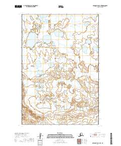
2019 Map of Nushagak Bay C-4 NE
USGS Topo · Published 2019About this map
Nushagak Peninsula dominates this coastal landscape in the Dillingham Census Area, characterized by an extensive network of wetlands and tidal flats. The north-flowing Tunuing River meanders through the central and eastern portions of the quadrangle, serving as the primary drainage for the surrounding marshy terrain. The landscape is defined by its low elevation and complex hydrology, with numerous small unnamed lakes and interconnected ponds filling the spaces between the Tunuing River and the peninsula shoreline. This map illustrates the intricate water patterns of southwestern Alaska before modern development, focusing entirely on the natural hydrography and terrain of the peninsula. Public land survey boundaries such as T17S R59W and T18S R60W provide the only structural grid over this undeveloped coastal expanse.
Find a feature on this map
8 named features on this map. Tap any name to fly to it.
Don’t see what you’re looking for? This feature index may not catch every label — zoom into the map to look around manually.
Map Details
Editions of this 2019 Nushagak Bay C-4 NE Map
This is the sole edition of this map. No revisions or reprints were ever made.
Other maps of this area

1945 · Nushagak Bay
USGS Topo · 1:250,000

1948 · Nushagak Bay D-4
USGS Topo · 1:63,360

1948 · Nushagak Bay D-3
USGS Topo · 1:63,360

1948 · Nushagak Bay C-4 And C-5
USGS Topo · 1:63,360

1949 · Nushagak Bay
USGS Topo · 1:250,000

1950 · Nushagak Bay C-3
USGS Topo · 1:63,360

1950 · Nushagak Bay C-4 And C-5
USGS Topo · 1:63,360

1951 · Nushagak Bay
USGS Topo · 1:250,000

1952 · Nushagak Bay D-3
USGS Topo · 1:63,360

1952 · Nushagak Bay D-4
USGS Topo · 1:63,360