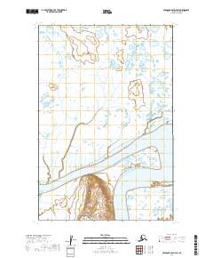
2019 Map of Nushagak Bay D-3 SW
USGS Topo · Published 2019About this map
Igushik River dominates this coastal landscape in the Dillingham Census Area, winding through a complex network of wetlands and tidal flats typical of the Bristol Bay region. The river's broad path and shifting channels reflect the dynamic nature of this Alaskan drainage system, where the land and water are constantly reshaped by tidal influences. To the south, Igushik Ridge provides a distinct change in elevation, rising above the low-lying marshes that characterize much of the surrounding township boundaries of t16s r58w and t15s r58w. This survey captures the topographical contrast between the river's meandering course and the adjacent upland terrain, offering a clear view of the area's natural drainage patterns and the intersection of terrestrial and aquatic ecosystems in southwest Alaska.
Find a feature on this map
6 named features on this map. Tap any name to fly to it.
Don’t see what you’re looking for? This feature index may not catch every label — zoom into the map to look around manually.
Map Details
Editions of this 2019 Nushagak Bay D-3 SW Map
This is the sole edition of this map. No revisions or reprints were ever made.
Other maps of this area

1945 · Nushagak Bay
USGS Topo · 1:250,000

1948 · Nushagak Bay D-4
USGS Topo · 1:63,360

1948 · Nushagak Bay D-3
USGS Topo · 1:63,360

1948 · Nushagak Bay C-4 And C-5
USGS Topo · 1:63,360

1949 · Nushagak Bay
USGS Topo · 1:250,000

1950 · Nushagak Bay C-3
USGS Topo · 1:63,360

1950 · Nushagak Bay C-4 And C-5
USGS Topo · 1:63,360

1951 · Nushagak Bay
USGS Topo · 1:250,000

1952 · Nushagak Bay D-3
USGS Topo · 1:63,360

1952 · Nushagak Bay D-4
USGS Topo · 1:63,360