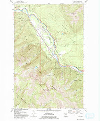
1964 Map of Nyack
USGS Topo · Published 1994About this map
The Middle Fork Flathead River carves a deep path through John F. Stevens Canyon, serving as a natural boundary between Glacier National Park to the northeast and the Great Bear Wilderness to the southwest. This mountainous region is defined by the logistical corridor of the Great Northern railroad and the Theodore Roosevelt Recreation Way, which follow the river's course past the small settlement of Nyack. A network of drainage systems, including Nyack Creek and Harrison Creek, feed into the main waterway from the surrounding heights of Mount Penrose and Loneman Mountain. The presence of the Nyack Ranger Station and the Loneman Lookout point to the early forest management and fire observation infrastructure essential to this heavily timbered landscape. Local industry and road development are evidenced by a Borrow Pit and Quarry situated near the riverbanks, illustrating the human footprint within this protected wilderness during the mid-1960s.
Find a feature on this map
40 named features on this map. Tap any name to fly to it.
Don’t see what you’re looking for? This feature index may not catch every label — zoom into the map to look around manually.
Map Details
Editions of this 1964 Nyack Map
3 editions found
Other maps of this area

1904 · Chief Mountain
USGS Topo · 1:125,000

1914 · Nyack
USGS Topo · 1:125,000

1938 · Chief Mountain
USGS Topo · 1:125,000

1960 · Cut Bank
USGS Topo · 1:250,000

1963 · Cut Bank
USGS Topo · 1:250,000

1964 · Cut Bank
USGS Topo · 1:250,000

1964 · Nyack
USGS Topo · 1:24,000

1964 · Pinnacle
USGS Topo · 1:24,000

1964 · Stanton Lake
USGS Topo · 1:24,000
1964 · Nyack SW
USGS Topo · 1:24,000