
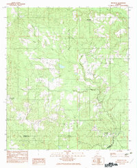
1982 Map of Nymph
USGS Topo · Published 1982About this map
Old Sparta and the surrounding rural landscapes of northern Alabama are documented here during the transition from the mid-to-late 1970s. The terrain is defined by an intricate network of waterways, including the winding course of Little Cedar Creek and its many tributaries like Feagin Creek and Sandy Creek. Small settlements like Nymph and Jay Villa are situated among a series of named water bodies such as McMillan Pond, Shipps Pond, and Weaver Pond, suggesting a landscape of private holdings and managed land use.
Find a feature on this map
18 named features on this map. Tap any name to fly to it.
Don’t see what you’re looking for? This feature index may not catch every label — zoom into the map to look around manually.
Map Details
Editions of this 1982 Nymph Map
This is the sole edition of this map. No revisions or reprints were ever made.
Other maps of this area

1953 · Andalusia
USGS Topo · 1:250,000

1957 · Andalusia
USGS Topo · 1:250,000

1960 · Brewton North
USGS Topo · 1:24,000

1971 · Castleberry
USGS Topo · 1:24,000

1971 · Belleville
USGS Topo · 1:24,000

1982 · Shipps Creek
USGS Topo · 1:24,000

1982 · Evergreen
USGS Topo · 1:24,000

1982 · Damascus
USGS Topo · 1:24,000

1982 · Old Town
USGS Topo · 1:24,000
1982 · Brooklyn
USGS Topo · 1:24,000