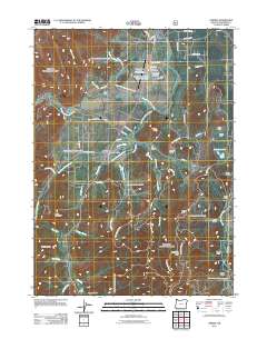
2011 Map of O'Brien
USGS Topo · Published 2011About this map
The West Fork Illinois River and its numerous tributaries, including Rough and Ready Creek and O'Brien Creek, define this pocket of Josephine County. The community of O'Brien is central to the area, marked by the O'Brien Post Office along the main transit corridor. Evidence of the region's industrial and aeronautical history is visible through the Illinois Valley US Forest Service Airstrip and the nearby Siskiyou Aerial Project Complex.
Find a feature on this map
72 named features on this map. Tap any name to fly to it.
Don’t see what you’re looking for? This feature index may not catch every label — zoom into the map to look around manually.
Map Details
Editions of this 2011 O'Brien Map
This is the sole edition of this map. No revisions or reprints were ever made.
Other maps of this area

1917 · Kerby
USGS Topo · 1:125,000

1918 · Kerby
USGS Topo · 1:125,000

1922 · Preston Peak
USGS Topo · 1:125,000

1945 · Kerby
USGS Topo · 1:125,000

1945 · Gasquet
USGS Topo · 1:62,500

1948 · Weed
USGS Topo · 1:250,000

1950 · Weed
USGS Topo · 1:250,000

1951 · Gasquet
USGS Topo · 1:62,500

1954 · Cave Junction
USGS Topo · 1:62,500

1954 · Chetco Peak
USGS Topo · 1:62,500