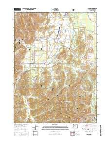
2014 Map of O'Brien
USGS Topo · Published 2014About this map
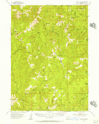
The community of O'Brien serves as a central hub for this portion of the Illinois Valley, where the Redwood Hwy facilitates travel through the southwestern Oregon landscape. The area is defined by the convergence of the West Fork Illinois River and its numerous tributaries, which have carved a complex system of gulches such as French Flat, Sailor Gulch, and Butcher Gulch. Local industry and infrastructure are represented by the Illinois Valley Airport and the Rough and Ready Mill Pond Dam along Rough and Ready Creek. Much of the territory is contained within the Siskiyou National Forest, characterized by prominent elevations like Lone Mtn and Bearcamp Ridge. For those examining land use and local hydrology, the map details many small watercourses including Leuzinger Cr, Parker Cr, and Mendenhall Cr, alongside man-made features like Esterly Lakes and Logan Cut.
Find a feature on this map
70 named features on this map. Tap any name to fly to it.
Don’t see what you’re looking for? This feature index may not catch every label — zoom into the map to look around manually.
Map Details
Editions of this 2014 O'Brien Map
This is the sole edition of this map. No revisions or reprints were ever made.
Other maps of this area
1917 · Kerby
USGS Topo · 1:125,000
1918 · Kerby
USGS Topo · 1:125,000
1922 · Preston Peak
USGS Topo · 1:125,000
1945 · Kerby
USGS Topo · 1:125,000
1945 · Gasquet
USGS Topo · 1:62,500

1948 · Weed
USGS Topo · 1:250,000

1950 · Weed
USGS Topo · 1:250,000
1951 · Gasquet
USGS Topo · 1:62,500
1954 · Cave Junction
USGS Topo · 1:62,500
1954 · Chetco Peak
USGS Topo · 1:62,500