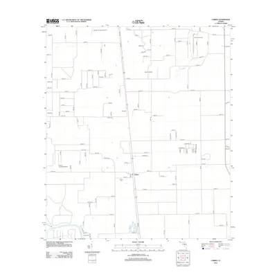
2012 Map of O'Brien
USGS Topo · Published 2012About this map
The settlement of O'Brien sits at the heart of this Suwannee County landscape, serving as a hub for a network of rural roads and agricultural aviation. This 2012 survey documents an area defined by its varied airfields, including Buddy's Ag Service Airport in the north and the O'Brien Airpark East/West to the west. These private strips suggest a community deeply tied to aerial crop management and local flight. Genealogy researchers will find the centrally located O'Brien Cem as a key point of interest for local family history. The natural geography is shaped by the winding course of the Little River and the presence of Troy Spring in the southwest corner, highlighting the region's connection to the Floridan aquifer and its unique river systems.
Find a feature on this map
59 named features on this map. Tap any name to fly to it.
Don’t see what you’re looking for? This feature index may not catch every label — zoom into the map to look around manually.
Map Details
Editions of this 2012 O'Brien Map
This is the sole edition of this map. No revisions or reprints were ever made.
Other maps of this area

1954 · Mallory Swamp NE
USGS Topo · 1:24,000

1954 · Gainesville
USGS Topo · 1:250,000

1954 · Valdosta
USGS Topo · 1:250,000

1955 · Mayo NE
USGS Topo · 1:24,000

1955 · Mayo SE
USGS Topo · 1:24,000

1958 · Valdosta
USGS Topo · 1:250,000

1958 · Gainesville
USGS Topo · 1:250,000

1959 · Valdosta
USGS Topo · 1:250,000

1959 · Gainesville
USGS Topo · 1:250,000

1968 · Branford
USGS Topo · 1:24,000