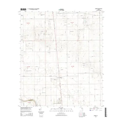
2015 Map of O'Brien
USGS Topo · Published 2015About this map
O'Brien serves as the central hub of this Suwannee County landscape, where the local economy is tied to the land and private aviation. The area is dotted with small-scale airfields, including Buddy's Ag Service Airport, Buckner Airport, and O'Brien Airpark East/West, reflecting the region's agricultural and general aviation character. For those researching local lineages, several burial grounds are documented, such as O'Brien Cem, Grove Cem, and Cedar Grove Cem. To the southwest, the Suwannee River forms the boundary between Suwannee and Lafayette counties, where Troy Spring marks a distinctive hydrological feature of the North Florida karst terrain. The map also traces the winding path of the Little River, which feeds into the larger river system, cutting through a grid of numbered roads that define the rural property divisions of the early 21st century.
Find a feature on this map
59 named features on this map. Tap any name to fly to it.
Don’t see what you’re looking for? This feature index may not catch every label — zoom into the map to look around manually.
Map Details
Editions of this 2015 O'Brien Map
This is the sole edition of this map. No revisions or reprints were ever made.
Other maps of this area

1954 · Mallory Swamp NE
USGS Topo · 1:24,000

1954 · Gainesville
USGS Topo · 1:250,000

1954 · Valdosta
USGS Topo · 1:250,000

1955 · Mayo NE
USGS Topo · 1:24,000

1955 · Mayo SE
USGS Topo · 1:24,000

1958 · Valdosta
USGS Topo · 1:250,000

1958 · Gainesville
USGS Topo · 1:250,000

1959 · Valdosta
USGS Topo · 1:250,000

1959 · Gainesville
USGS Topo · 1:250,000

1968 · Branford
USGS Topo · 1:24,000