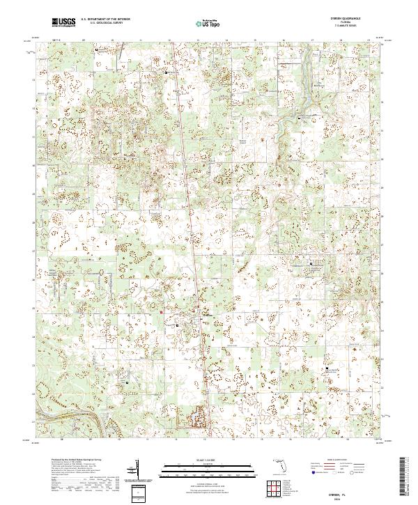
2024 Map of O'Brien
USGS Topo · Published 2024About this map
O'Brien serves as the central hub of this agricultural landscape in Suwannee County, where the southern boundary follows the path of the Suwannee River. The region's history is preserved in a dense network of local burial grounds, including the O'Brien Cem, Ida Grove Cem, and Cedar Grove Cem. These sites, along with church yards like the Mount Pisgah Baptist Church Cem and Union Baptist Church Cem, highlight the genealogical depth of the surrounding rural communities. The terrain is marked by hydrological features such as Troy Spring and the Little River, while the presence of O'Brien Airpark East/West, Little River Airport, and Buckner Airport suggests a modern reliance on private aviation. The map also delineates the jurisdictional boundary at the Suwannee Co Lafayette Co line, illustrating the intersection of county administration and the natural river course.
Find a feature on this map
63 named features on this map. Tap any name to fly to it.
Don’t see what you’re looking for? This feature index may not catch every label — zoom into the map to look around manually.
Map Details
Editions of this 2024 O'Brien Map
This is the sole edition of this map. No revisions or reprints were ever made.
Other maps of this area

1954 · Mallory Swamp NE
USGS Topo · 1:24,000

1954 · Gainesville
USGS Topo · 1:250,000

1954 · Valdosta
USGS Topo · 1:250,000

1955 · Mayo NE
USGS Topo · 1:24,000

1955 · Mayo SE
USGS Topo · 1:24,000

1958 · Valdosta
USGS Topo · 1:250,000

1958 · Gainesville
USGS Topo · 1:250,000

1959 · Valdosta
USGS Topo · 1:250,000

1959 · Gainesville
USGS Topo · 1:250,000

1968 · Branford
USGS Topo · 1:24,000