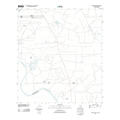
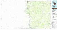
2010 Map of O'Keefe Lake
USGS Topo · Published 2010About this map
Rio Bravo and El Cenizo stand as significant borderland settlements along the northern banks of the Rio Grande in this southern Texas landscape. The map reveals a transition from these concentrated residential colonias to more open, arid terrain shaped by water management and ranching infrastructure. Numerous dams and reservoirs punctuate the landscape, including O'Keefe Lake with its associated O'Keefe Dam, and the extensive Falcon Reservoir along the international boundary.
Find a feature on this map
17 named features on this map. Tap any name to fly to it.
Don’t see what you’re looking for? This feature index may not catch every label — zoom into the map to look around manually.
Map Details
Editions of this 2010 O'Keefe Lake Map
This is the sole edition of this map. No revisions or reprints were ever made.
Other maps of this area

1933 · Becerra Creek
USGS Topo · 1:62,500

1942 · San Ygnacio
USGS Topo · 1:62,500

1956 · Laredo
USGS Topo · 1:250,000
1979 · Isla Mesteno
USGS Topo · 1:24,000

1979 · Laredo South
USGS Topo · 1:24,000

1979 · O'Keefe Lake
USGS Topo · 1:24,000

1980 · Blancas Creek North
USGS Topo · 1:24,000
1980 · Blancas Creek South
USGS Topo · 1:24,000
1980 · Arroyo Salado East
USGS Topo · 1:24,000
1985 · San Ygnacio
USGS Topo · 1:100,000