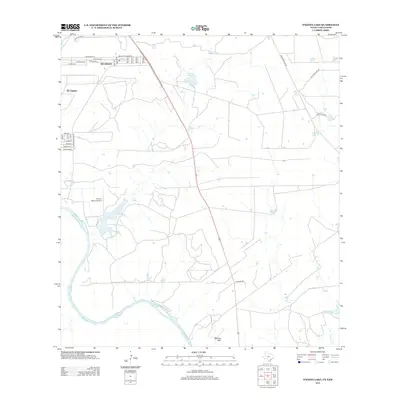
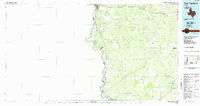
2013 Map of O'Keefe Lake
USGS Topo · Published 2013About this map
The Rio Grande serves as the international boundary along the southwestern edge of this Webb County survey, shaping the development of neighboring border communities. The settlements of Rio Bravo and El Cenizo are established along the river's northern banks, characterized by a dense grid of residential streets like Paseo De Danubio Rd and Espejo Molina Rd. Moving inland, the landscape shifts toward large ranching tracts and open terrain, punctuated by the Mendez Hills and several isolated water bodies including O'Keefe Lake and La Perla Ranch Lake Number 1. Transportation in this semi-arid region is anchored by the Mangana-Hein Rd corridor and the private Rancho Blanco Airport, which support the area's agricultural and logistical needs. Smaller waterways like Dolores Cr carve through the brushland, marking the natural drainage patterns of this South Texas borderland.
Find a feature on this map
35 named features on this map. Tap any name to fly to it.
Don’t see what you’re looking for? This feature index may not catch every label — zoom into the map to look around manually.
Map Details
Editions of this 2013 O'Keefe Lake Map
This is the sole edition of this map. No revisions or reprints were ever made.
Other maps of this area

1933 · Becerra Creek
USGS Topo · 1:62,500

1942 · San Ygnacio
USGS Topo · 1:62,500

1956 · Laredo
USGS Topo · 1:250,000
1979 · Isla Mesteno
USGS Topo · 1:24,000

1979 · Laredo South
USGS Topo · 1:24,000

1979 · O'Keefe Lake
USGS Topo · 1:24,000

1980 · Blancas Creek North
USGS Topo · 1:24,000
1980 · Blancas Creek South
USGS Topo · 1:24,000
1980 · Arroyo Salado East
USGS Topo · 1:24,000
1985 · San Ygnacio
USGS Topo · 1:100,000