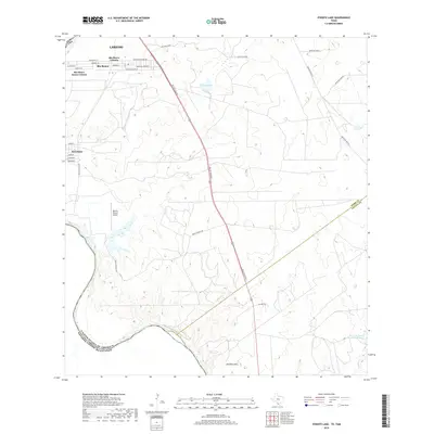
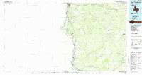
2019 Map of O'Keefe Lake
USGS Topo · Published 2019About this map
The Rio Grande serves as the international boundary between the United States and Mexico in this South Texas borderland. The landscape is defined by the rapid growth of colonias south of Laredo, where residential developments like Rio Bravo Colonia and Rio Bravo Annex Colonia are densely platted alongside El Cenizo. Away from the river, the terrain transitions into ranching country, evidenced by Rugama Ranch and the open land surrounding Mendez Hills. The presence of the Rancho Blanco Airport and major transit corridors like Hwy 83 Access Rd highlight the region's importance as a transportation hub. Water features are sparse but significant, including the namesake O'Keefe Lake and the La Perla Ranch Lake Number 1, which sustain the local cattle industry in this arid environment.
Find a feature on this map
34 named features on this map. Tap any name to fly to it.
Don’t see what you’re looking for? This feature index may not catch every label — zoom into the map to look around manually.
Map Details
Editions of this 2019 O'Keefe Lake Map
This is the sole edition of this map. No revisions or reprints were ever made.
Other maps of this area

1933 · Becerra Creek
USGS Topo · 1:62,500

1942 · San Ygnacio
USGS Topo · 1:62,500

1956 · Laredo
USGS Topo · 1:250,000
1979 · Isla Mesteno
USGS Topo · 1:24,000

1979 · Laredo South
USGS Topo · 1:24,000

1979 · O'Keefe Lake
USGS Topo · 1:24,000

1980 · Blancas Creek North
USGS Topo · 1:24,000
1980 · Blancas Creek South
USGS Topo · 1:24,000
1980 · Arroyo Salado East
USGS Topo · 1:24,000
1985 · San Ygnacio
USGS Topo · 1:100,000