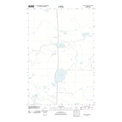
2010 Map of O'Leary Lake
USGS Topo · Published 2010About this map
Prairie River and its accompanying Prairie Lake dominate the northern terrain of this Itasca County landscape. The area is defined by a dense network of glacial water bodies and meandering waterways, including the winding course of Day Brook and the East River. The central portion of the map is anchored by O' Leary Lake and the larger Buck Lake, which serve as focal points for a local road system including Day Brook River Rd and County Hwy-540. To the south, smaller water features like McGrady Lake and Little Buck Lake appear amidst the wetlands. This survey highlights the character of the Minnesota Northwoods, where the land is heavily shaped by its hydrography and forestry roads such as Bower Lake Forest Rd.
Find a feature on this map
26 named features on this map. Tap any name to fly to it.
Don’t see what you’re looking for? This feature index may not catch every label — zoom into the map to look around manually.
Map Details
Editions of this 2010 O'Leary Lake Map
This is the sole edition of this map. No revisions or reprints were ever made.
Other maps of this area

1919 · Release
USGS Topo · 1:62,500

1920 · Trout Lake
USGS Topo · 1:62,500

1943 · Release
USGS Topo · 1:62,500

1952 · Keewatin
USGS Topo · 1:24,000

1952 · Nashwauk
USGS Topo · 1:24,000

1954 · Hibbing
USGS Topo · 1:250,000

1957 · Hibbing
USGS Topo · 1:250,000

1958 · Hibbing
USGS Topo · 1:250,000

1964 · Hibbing
USGS Topo · 1:250,000

1964 · Side Lake
USGS Topo · 1:24,000