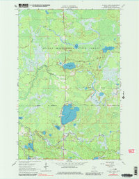
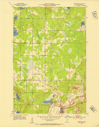
1964 Map of O'Leary Lake
USGS Topo · Published 1980About this map
George Washington State Forest encompasses most of this landscape in Itasca County, defined by a complex network of glacial lakes and wetlands during the mid-1960s. The hydrology is dominated by the Prairie River and its tributaries, such as Day Brook and East River, which connect numerous smaller water bodies. Large basins like Buck Lake and O'Leary Lake are central features, while smaller, secluded spots like McGrady Lake and Harrison Lake dot the forested interior. The map reflects a region primarily dedicated to conservation and natural resource management, with evidence of local extractive activity shown at several sandpits and a gravel pit located near the forest trails. This survey provides a baseline of the northern Minnesota wilderness before later 20th-century shifts in land use or recreational development.
Find a feature on this map
18 named features on this map. Tap any name to fly to it.
Don’t see what you’re looking for? This feature index may not catch every label — zoom into the map to look around manually.
Map Details
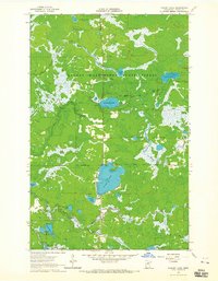
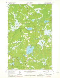
Editions of this 1964 O'Leary Lake Map
3 editions found
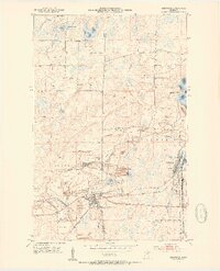
Other maps of this area

1919 · Release
USGS Topo · 1:62,500

1920 · Trout Lake
USGS Topo · 1:62,500

1943 · Release
USGS Topo · 1:62,500
1952 · Keewatin
USGS Topo · 1:24,000
1952 · Nashwauk
USGS Topo · 1:24,000

1954 · Hibbing
USGS Topo · 1:250,000

1957 · Hibbing
USGS Topo · 1:250,000

1958 · Hibbing
USGS Topo · 1:250,000

1964 · Hibbing
USGS Topo · 1:250,000
1964 · Side Lake
USGS Topo · 1:24,000