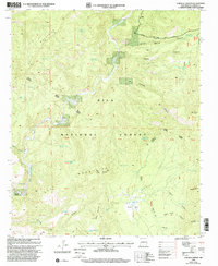
1999 Map of O Block Canyon
USGS Topo · Published 2002About this map
The San Francisco River cuts through the heart of the Gila National Forest in this late-twentieth-century study of Catron County. The landscape is defined by the high elevations of the Saliz Mountains and the Mogollon Divide, where water management is critical for ranching and forest maintenance. A network of cattle-tanks, such as Kelly Brushy Tank, Cripple Saddle Tank, and Frying Pan Tank, dot the drainage basins of Gatlin Canyon and Saliz Canyon. Evidence of localized settlement and land use appears at the K Kelly Ranch and the Devils Park Corral near Devils Park. The survey also documents the Reserve Glenwood Road, which provides the primary access through these high-altitude canyons, connecting the isolated watering holes and peaks like Apache Peak and Black Mountain.
Find a feature on this map
53 named features on this map. Tap any name to fly to it.
Don’t see what you’re looking for? This feature index may not catch every label — zoom into the map to look around manually.
Map Details
Editions of this 1999 O Block Canyon Map
This is the sole edition of this map. No revisions or reprints were ever made.
Other maps of this area

1910 · Mogollon
USGS Topo · 1:125,000

1912 · Mogollon
USGS Topo · 1:125,000

1915 · Reserve
USGS Topo · 1:125,000

1918 · Reserve
USGS Topo · 1:125,000

1954 · Clifton
USGS Topo · 1:250,000

1957 · Clifton
USGS Topo · 1:250,000

1958 · Clifton
USGS Topo · 1:250,000

1962 · Clifton
USGS Topo · 1:250,000

1963 · Bearwallow Mountain
USGS Topo · 1:24,000
1963 · Sign Camp Mountain
USGS Topo · 1:24,000