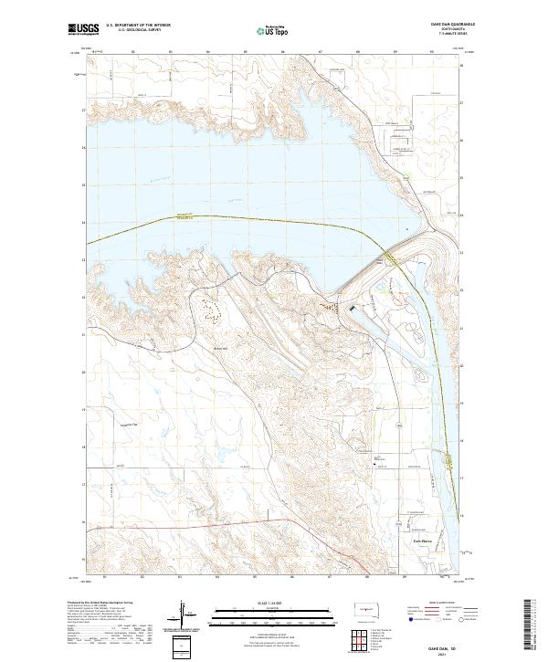
2021 Map of Oahe Dam
USGS Topo · Published 2021About this map
The Missouri River forms the central spine of this landscape, dominated by the massive engineering of the Oahe Dam. This infrastructure creates a sharp division between the northern expanse of Lake Oahe and the lower waters of Lake Sharpe to the south. Along the western banks, the terrain rises into the prominent Brown Hill and the broad terrace of Giddings Flat.
Find a feature on this map
42 named features on this map. Tap any name to fly to it.
Don’t see what you’re looking for? This feature index may not catch every label — zoom into the map to look around manually.
Map Details
Editions of this 2021 Oahe Dam Map
This is the sole edition of this map. No revisions or reprints were ever made.
Other maps of this area

1924 · Pierre
USGS Topo · 1:62,500

1937 · Oahe
USGS Topo · 1:62,500

1953 · Teton
USGS Topo · 1:24,000

1953 · Pierre SW
USGS Topo · 1:24,000

1954 · Pierre
USGS Topo · 1:250,000

1958 · Pierre
USGS Topo · 1:250,000

1967 · Pierre NE
USGS Topo · 1:24,000
1967 · Okobojo SE
USGS Topo · 1:24,000
1973 · Iron Post Buttes SE
USGS Topo · 1:24,000
1973 · Pierre
USGS Topo · 1:24,000