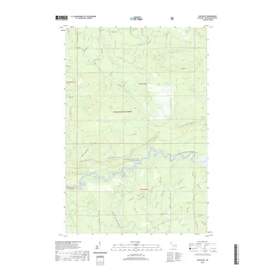
2019 Map of Oak Bluff
USGS Topo · Published 2019About this map
The Ontonagon Wild and Scenic River carves through this northern Michigan landscape, where the W Branch Ontonagon River and the South Branch converge near the Victoria Reservoir. This 2019 survey documents a wilderness character defined by the Ottawa National Forest, with significant water features like Sandstone Falls and Gleason Creek Falls punctuating the drainage network. High points like Oak Bluff overlook a series of creeks, including Deer Cr and Mill Cr, which flow toward the central river valley. The map illustrates a balance between modern recreational access, such as the N Country National Scenic Trail, and historic logging or utility corridors like Victoria Rd. The dense network of National Forest System roads, such as Nfst-687, indicates the managed nature of this timber and water resource area.
Find a feature on this map
73 named features on this map. Tap any name to fly to it.
Don’t see what you’re looking for? This feature index may not catch every label — zoom into the map to look around manually.
Map Details
Editions of this 2019 Oak Bluff Map
This is the sole edition of this map. No revisions or reprints were ever made.
Other maps of this area

1949 · Matchwood NW
USGS Topo · 1:24,000

1949 · Rockland
USGS Topo · 1:62,500

1950 · Greenland
USGS Topo · 1:62,500

1951 · Rockland
USGS Topo · 1:62,500

1951 · Greenland
USGS Topo · 1:62,500

1955 · Ontonagon
USGS Topo · 1:62,500

1956 · Matchwood NW
USGS Topo · 1:24,000

1956 · Matchwood
USGS Topo · 1:62,500

1958 · Iron River
USGS Topo · 1:250,000

1960 · Iron River
USGS Topo · 1:250,000