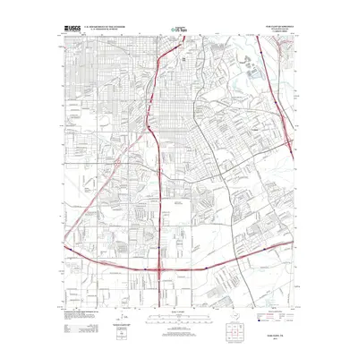
2012 Map of Oak Cliff
USGS Topo · Published 2012About this map
Oak Cliff and its surrounding communities are documented in this 2012 survey, capturing the dense residential and industrial footprint of South Dallas. The map illustrates a landscape heavily defined by modern transportation corridors, with the S R L Thornton Fwy and S Central Expy slicing through historic neighborhoods. Despite this development, the area's older roots are visible in the placement of Lisbon Cem and Wheatland Cem, along with the older settlement patterns in Sargent and Fruitdale.
Find a feature on this map
233 named features on this map. Tap any name to fly to it.
Don’t see what you’re looking for? This feature index may not catch every label — zoom into the map to look around manually.
Map Details
Editions of this 2012 Oak Cliff Map
This is the sole edition of this map. No revisions or reprints were ever made.
Other maps of this area

1891 · Dallas
USGS Topo · 1:125,000

1893 · Dallas
USGS Topo · 1:125,000

1931 · Carrollton
USGS Topo · 1:62,500

1954 · Dallas
USGS Topo · 1:250,000

1957 · White Rock Lake
USGS Topo · 1:24,000

1958 · Dallas
USGS Topo · 1:250,000

1958 · Hutchins
USGS Topo · 1:24,000

1958 · Oak Cliff
USGS Topo · 1:24,000

1958 · Dallas
USGS Topo · 1:24,000

1958 · White Rock Lake
USGS Topo · 1:24,000