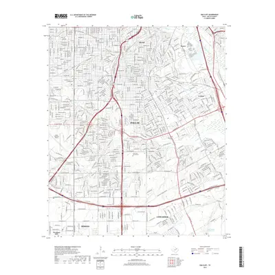
2019 Map of Oak Cliff
USGS Topo · Published 2019About this map
Oak Cliff and its surrounding southern Dallas neighborhoods are captured here during a period of dense urban and suburban development. The landscape is defined by its complex drainage network, where Fivemile Cr, Coombs Cr, and Little Cedar Cr carve through the residential grid toward the Trinity River in the northeast. This 2019 survey provides essential detail for local historians, showing the proximity of long-standing sites like Oak Cliff Cem and Wheatland Cem to modern infrastructure such as the Dallas Executive Airport. The map also traces the transition into northern Lancaster and DeSoto, with Laurel Land Memorial Park serving as a significant green space amidst the sprawling residential blocks and the major transit corridors of the S R L Thornton Fwy and Central Expy.
Find a feature on this map
57 named features on this map. Tap any name to fly to it.
Don’t see what you’re looking for? This feature index may not catch every label — zoom into the map to look around manually.
Map Details
Editions of this 2019 Oak Cliff Map
This is the sole edition of this map. No revisions or reprints were ever made.
Other maps of this area

1891 · Dallas
USGS Topo · 1:125,000

1893 · Dallas
USGS Topo · 1:125,000

1931 · Carrollton
USGS Topo · 1:62,500

1954 · Dallas
USGS Topo · 1:250,000

1957 · White Rock Lake
USGS Topo · 1:24,000

1958 · Dallas
USGS Topo · 1:250,000

1958 · Hutchins
USGS Topo · 1:24,000

1958 · Oak Cliff
USGS Topo · 1:24,000

1958 · Dallas
USGS Topo · 1:24,000

1958 · White Rock Lake
USGS Topo · 1:24,000