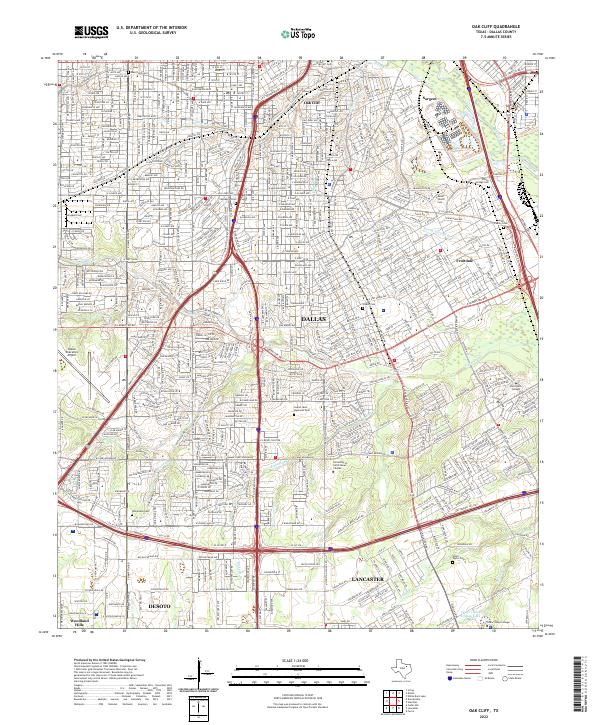
2022 Map of Oak Cliff
USGS Topo · Published 2022About this map
Dallas and its southern suburbs are defined here by a dense grid of residential streets and essential community institutions. The southern reaches of the city include the long-standing community of Oak Cliff, where Oak Cliff Cem serves as a significant local landmark. The landscape is marked by several family burying grounds, such as the Miller Family Cem and Smith Family Cem, alongside the sprawling Laurel Land Memorial Park. Educational hubs are prominent throughout the area, featuring the University of North Texas - Dallas, Paul Quinn College, and Cedar Valley College. To the west, the Dallas Executive Airport anchors the transportation network. Drainage is provided by the winding courses of Fivemile Cr and Cedar Cr, which carve through the urban layout. The map also captures the boundaries where the city meets Lancaster and DeSoto, reflecting the continued expansion into southern Dallas County.
Find a feature on this map
66 named features on this map. Tap any name to fly to it.
Don’t see what you’re looking for? This feature index may not catch every label — zoom into the map to look around manually.
Map Details
Editions of this 2022 Oak Cliff Map
This is the sole edition of this map. No revisions or reprints were ever made.
Other maps of this area

1891 · Dallas
USGS Topo · 1:125,000

1893 · Dallas
USGS Topo · 1:125,000

1931 · Carrollton
USGS Topo · 1:62,500

1954 · Dallas
USGS Topo · 1:250,000

1957 · White Rock Lake
USGS Topo · 1:24,000

1958 · Dallas
USGS Topo · 1:250,000

1958 · Hutchins
USGS Topo · 1:24,000

1958 · Oak Cliff
USGS Topo · 1:24,000

1958 · Dallas
USGS Topo · 1:24,000

1958 · White Rock Lake
USGS Topo · 1:24,000