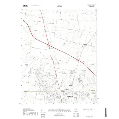
2019 Map of Oak Grove
USGS Topo · Published 2019About this map
Oak Grove and the northern outskirts of Clarksville anchor this 2019 survey, which documents the interstate-driven development along the border of Kentucky and Tennessee. The landscape is a study in transition, where residential developments like the Idlewild Subdivision and commercial corridors along Fort Campbell Blvd meet the enduring rural layout of smaller communities. Scattered hamlets such as Fidelio, Saint Elmo, and Kennedy are connected by a network of local roads like Bardwell-Fidelio Rd and Barkers Mill Rd, reflecting the area's agricultural past and early road networks.
Find a feature on this map
164 named features on this map. Tap any name to fly to it.
Don’t see what you’re looking for? This feature index may not catch every label — zoom into the map to look around manually.
Map Details
Editions of this 2019 Oak Grove Map
This is the sole edition of this map. No revisions or reprints were ever made.
Other maps of this area

1944 · Clarksville
USGS Topo · 1:50,000

1950 · Pembroke
USGS Topo · 1:24,000

1951 · Pembroke
USGS Topo · 1:24,000

1951 · Church Hill
USGS Topo · 1:24,000

1951 · Hopkinsville
USGS Topo · 1:24,000

1951 · New Providence
USGS Topo · 1:24,000

1951 · Hammacksville
USGS Topo · 1:24,000

1951 · Clarksville
USGS Topo · 1:24,000

1951 · Herndon
USGS Topo · 1:24,000

1951 · Oak Grove
USGS Topo · 1:24,000