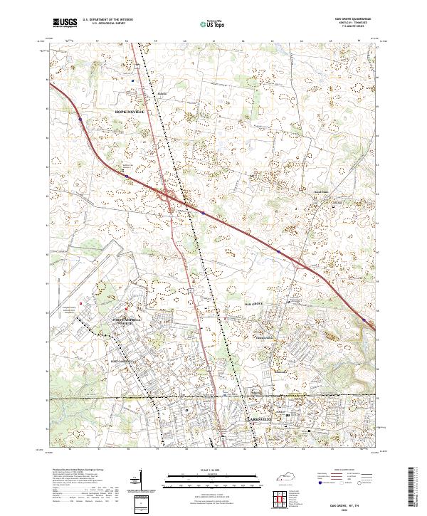
2022 Map of Oak Grove
USGS Topo · Published 2022About this map
The Kentucky and Tennessee state line bisects this region, separating Christian County and Montgomery County. Much of the western landscape is dominated by the sprawling installations of Fort Campbell North, featuring the extensive Campbell Army Airfield and a complex network of tactical roads like Nightstalker Way. This military footprint contrasts with the residential clusters of Oak Grove and Hensleytown, which grew to serve the nearby post.
Find a feature on this map
187 named features on this map. Tap any name to fly to it.
Don’t see what you’re looking for? This feature index may not catch every label — zoom into the map to look around manually.
Map Details
Editions of this 2022 Oak Grove Map
This is the sole edition of this map. No revisions or reprints were ever made.
Other maps of this area

1944 · Clarksville
USGS Topo · 1:50,000

1950 · Pembroke
USGS Topo · 1:24,000

1951 · Pembroke
USGS Topo · 1:24,000

1951 · Church Hill
USGS Topo · 1:24,000

1951 · Hopkinsville
USGS Topo · 1:24,000

1951 · New Providence
USGS Topo · 1:24,000

1951 · Hammacksville
USGS Topo · 1:24,000

1951 · Clarksville
USGS Topo · 1:24,000

1951 · Herndon
USGS Topo · 1:24,000

1951 · Oak Grove
USGS Topo · 1:24,000