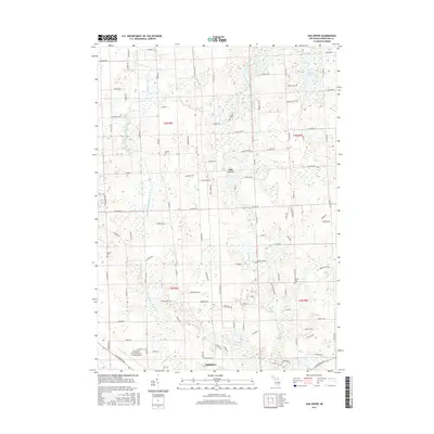
2017 Map of Oak Grove
USGS Topo · Published 2017About this map
The South Branch Shiawassee River snakes northward through this portion of Livingston County, defining a landscape of low-lying wetlands and scattered glacial lakes. The settlement of Oak Grove sits centrally along the river's path, serving as a historic focal point in an area largely characterized by rural road grids and drainage tributaries like Sprague Cr and Bogue Cr. To the south, the edge of Howell and the Livingston County Spencer J. Hardy Airport indicate the encroaching influence of more developed infrastructure.
Find a feature on this map
101 named features on this map. Tap any name to fly to it.
Don’t see what you’re looking for? This feature index may not catch every label — zoom into the map to look around manually.
Map Details
Editions of this 2017 Oak Grove Map
This is the sole edition of this map. No revisions or reprints were ever made.
Other maps of this area

1907 · Howell
USGS Topo · 1:62,500

1908 · Fowlerville
USGS Topo · 1:62,500

1909 · Howell
USGS Topo · 1:62,500

1910 · Fowlerville
USGS Topo · 1:62,500

1922 · Durand
USGS Topo · 1:62,500

1926 · Corunna
USGS Topo · 1:62,500

1929 · Corunna
USGS Topo · 1:62,500

1943 · Durand
USGS Topo · 1:62,500

1944 · Corunna
USGS Topo · 1:62,500

1954 · Detroit
USGS Topo · 1:250,000