
1956 Map of Oak Hill
USGS Topo · Published 1958About this map
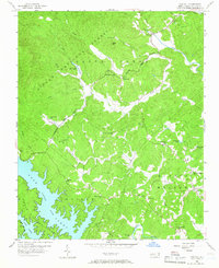
The Linville River and the northern reaches of Lake James dominate the southwestern corner of this mid-century landscape, where the waters of the Catawba River flow through the foothills. Much of the western and northern terrain is defined by the Pisgah National Forest, a heavily wooded area where drainage from Miller Mtn feeds into a network of creeks including Upper Creek and Irish Creek. The Tablerock State Fish Hatchery stands as a notable institutional landmark near the forest boundary, reflecting the region's managed natural resources.
Find a feature on this map
39 named features on this map. Tap any name to fly to it.
Don’t see what you’re looking for? This feature index may not catch every label — zoom into the map to look around manually.
Map Details
Editions of this 1956 Oak Hill Map
2 editions found
Other maps of this area

1905 · Morganton
USGS Topo · 1:125,000

1934 · Linville Falls
USGS Topo · 1:24,000

1953 · Charlotte
USGS Topo · 1:250,000

1954 · Charlotte
USGS Topo · 1:250,000

1956 · Collettsville
USGS Topo · 1:24,000

1956 · Morganton North
USGS Topo · 1:24,000

1956 · Ashford
USGS Topo · 1:24,000
1956 · Linville Falls
USGS Topo · 1:24,000

1956 · Morganton South
USGS Topo · 1:24,000
1956 · Chestnut Mtn.
USGS Topo · 1:24,000