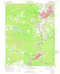
1969 Map of Oak Hill
USGS Topo · Published 1977About this map
The industrial and residential corridors of Fayette County are shown here during a period of transition, where the coal-driven geography of the plateau meets new developments. Oak Hill serves as the regional anchor, displaying a dense street grid including Central Ave and Virginia Ave, while smaller communities like Whipple, Scarbro, and Glen Jean line the narrow valleys to the south. The map documents the extensive presence of the mining industry, from Strip Mine operations on the ridges to a Tipple and Air Shaft near Carlisle.
Find a feature on this map
100 named features on this map. Tap any name to fly to it.
Don’t see what you’re looking for? This feature index may not catch every label — zoom into the map to look around manually.
Map Details
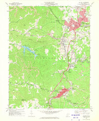
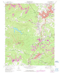
Editions of this 1969 Oak Hill Map
3 editions found
Other maps of this area

1891 · Raleigh
USGS Topo · 1:125,000

1897 · Kanawha Falls
USGS Topo · 1:125,000

1897 · Raleigh
USGS Topo · 1:125,000

1900 · Kanawha Falls
USGS Topo · 1:125,000

1901 · Kanawha Falls
USGS Topo · 1:125,000

1902 · Raleigh
USGS Topo · 1:125,000

1908 · Fayetteville
USGS Topo · 1:48,000

1908 · Montgomery
USGS Topo · 1:48,000

1910 · Fayetteville
USGS Topo · 1:62,500

1910 · Montgomery
USGS Topo · 1:62,500