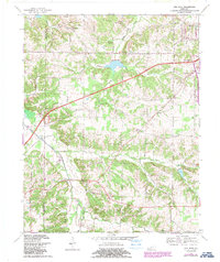
1969 Map of Oak Level
USGS Topo · Published 1988About this map
West Fork Clarks River and its numerous tributaries, including Soldier Creek and Smith Creek, define the landscape of this southern Kentucky region. At the time of this 1969 field check, later updated in 1987, the area around Oak Level maintained a rural character shaped by a network of local roads like Shamewell Road and Nance Road. The introduction of the Purchase Parkway across the center of the sheet highlights the transition toward modern infrastructure, intersecting older paths near Waller Hill. Local history and genealogy are centered on country churches and small cemeteries, such as Pleasant Grove Ch and Cole Cem, which are scattered throughout the hills. The terrain is notably varied, featuring prominent heights like Potato Hill and several quarries and gravel pits that suggest a local dependence on the land's raw materials.
Find a feature on this map
65 named features on this map. Tap any name to fly to it.
Don’t see what you’re looking for? This feature index may not catch every label — zoom into the map to look around manually.
Map Details
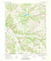
Editions of this 1969 Oak Level Map
2 editions found
Other maps of this area

1936 · Farmington
USGS Topo · 1:24,000

1936 · Oak Level
USGS Topo · 1:24,000

1936 · Elva
USGS Topo · 1:24,000

1936 · Hardin
USGS Topo · 1:24,000

1936 · Symsonia
USGS Topo · 1:24,000

1936 · Benton
USGS Topo · 1:48,000

1936 · Westplains
USGS Topo · 1:24,000

1936 · Dexter
USGS Topo · 1:24,000

1936 · Kirksey
USGS Topo · 1:24,000
1936 · Briensburg
USGS Topo · 1:24,000