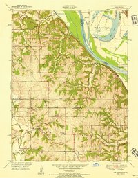
1948 Map of Oak Mills
USGS Topo · Published 1954About this map
The Missouri River forms the eastern boundary of this mid-century landscape, where the fertile bluffs of Walnut and Kickapoo townships overlook the sprawling Marshall bottoms. During this era, the riverbank was a hub of transit and commerce, anchored by Oak Mills and the former river port of Port Williams. To the west, the interior reveals a dense network of early rural social life, evidenced by one-room schoolhouses and country parishes like Round Prairie Church and St Patricks School.
Find a feature on this map
39 named features on this map. Tap any name to fly to it.
Don’t see what you’re looking for? This feature index may not catch every label — zoom into the map to look around manually.
Map Details
Editions of this 1948 Oak Mills Map
2 editions found

Other maps of this area

1885 · Atchison
USGS Topo · 1:125,000

1886 · Oskaloosa
USGS Topo · 1:125,000

1888 · Oskaloosa
USGS Topo · 1:125,000

1888 · Atchison
USGS Topo · 1:125,000

1890 · Kansas City
USGS Topo · 1:125,000

1893 · Atchison
USGS Topo · 1:125,000

1894 · Kansas City
USGS Topo · 1:125,000

1894 · Oskaloosa
USGS Topo · 1:125,000

1910 · Leavenworth
USGS Topo · 1:62,500

1926 · Atchison
USGS Topo · 1:62,500