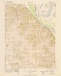
1951 Map of Oak Mills
USGS Topo · Published 1951About this map
Oak Mills and the bluffs of the Missouri River anchor this mid-century look at the border between Kansas and Missouri. The landscape is a patchwork of rural school districts and community centers, including School No 20, Corson Sch, and Wyman Sch. The presence of the Missouri Pacific and the Atchison Topeka and Santa Fe railroads illustrates the vital transportation corridors that shaped the Walnut and Kickapoo townships. In the river bottomlands, the distinctive curves of Bean Lake and Cottonwood Slough reveal the shifting course of the river before modern engineering fully stabilized the banks. Genealogists can find several small burial grounds, such as Mt Gillian Cem and the Van Winkle Cem, which serve as quiet markers of the families who settled this fertile river valley.
Find a feature on this map
43 named features on this map. Tap any name to fly to it.
Don’t see what you’re looking for? This feature index may not catch every label — zoom into the map to look around manually.
Map Details
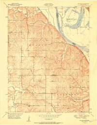
Editions of this 1951 Oak Mills Map
2 editions found
Other maps of this area

1885 · Atchison
USGS Topo · 1:125,000

1886 · Oskaloosa
USGS Topo · 1:125,000

1888 · Oskaloosa
USGS Topo · 1:125,000

1888 · Atchison
USGS Topo · 1:125,000

1890 · Kansas City
USGS Topo · 1:125,000

1893 · Atchison
USGS Topo · 1:125,000

1894 · Kansas City
USGS Topo · 1:125,000

1894 · Oskaloosa
USGS Topo · 1:125,000

1910 · Leavenworth
USGS Topo · 1:62,500

1926 · Atchison
USGS Topo · 1:62,500