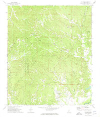
1972 Map of Oak Ridge
USGS Topo · Published 1974About this map
Oak Ridge serves as the primary settlement on this ridge-and-hollow landscape, characterized by a high density of family cemeteries and rural churches. Genealogists will find a significant record of local families through landmarks such as Neely Cem, Lewis Cem, and Parker Cem. The terrain is defined by the winding drainages of Battleground Creek and Clear Creek, while the Bluff Experimental Forest occupies the central western portion of the quadrangle. Small congregations are centered around houses of worship like Ridgeway Ch and Jones Chapel, reflecting the dispersed community structure common in rural Warren County during the early 1970s. The map also records early industrial and communication infrastructure, including a Radio Tower and the Oak Ridge Lookout Tower, set against the backdrop of the Black River which forms the southeastern boundary.
Find a feature on this map
38 named features on this map. Tap any name to fly to it.
Don’t see what you’re looking for? This feature index may not catch every label — zoom into the map to look around manually.
Map Details
Editions of this 1972 Oak Ridge Map
2 editions found
Other maps of this area

1918 · Vicksburg
USGS Topo · 1:62,500

1938 · Edwards
USGS Topo · 1:62,500

1939 · Onward
USGS Topo · 1:62,500

1940 · Mechanicsburg
USGS Topo · 1:62,500

1941 · Vicksburg
USGS Topo · 1:62,500

1955 · Jackson
USGS Topo · 1:250,000

1961 · Jackson
USGS Topo · 1:250,000

1962 · Jackson
USGS Topo · 1:250,000

1962 · Redwood
USGS Topo · 1:24,000

1962 · Vicksburg East
USGS Topo · 1:24,000