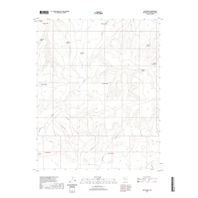
2020 Map of Oak Spring
USGS Topo · Published 2020About this map
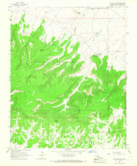
Oak Spring and Rock Spring serve as vital water points in this high-desert landscape of McKinley County, as documented in 2020. The terrain is defined by a series of dramatic drainages and landforms, including Red Mesa Canyon and the prominent Ram Mesa. The northern reaches are deeply carved by Soft Water Canyon and its associated Soft Water Wash, while the southern portion of the quadrangle flattens toward the path of the Puerco River. A network of rural routes and service roads, such as Chestnut Rd and Indian Svc Rte 7049, provides access through the canyon systems. This modern survey illustrates the enduring relationship between the topography and the sparse transit corridors that navigate the mesa country, where names like Dog Spring Canyon and Running Edge Canyon reflect the character of the New Mexico environment.
Find a feature on this map
27 named features on this map. Tap any name to fly to it.
Don’t see what you’re looking for? This feature index may not catch every label — zoom into the map to look around manually.
Map Details
Editions of this 2020 Oak Spring Map
This is the sole edition of this map. No revisions or reprints were ever made.
Other maps of this area

1886 · Wingate
USGS Topo · 1:250,000

1892 · Wingate
USGS Topo · 1:250,000

1954 · Gallup
USGS Topo · 1:250,000

1958 · Gallup
USGS Topo · 1:250,000

1959 · Gallup
USGS Topo · 1:250,000

1962 · Gallup
USGS Topo · 1:250,000
1963 · Mariano Lake
USGS Topo · 1:24,000
1963 · Pinedale
USGS Topo · 1:24,000
1963 · Church Rock
USGS Topo · 1:24,000
1963 · Dalton Pass
USGS Topo · 1:24,000