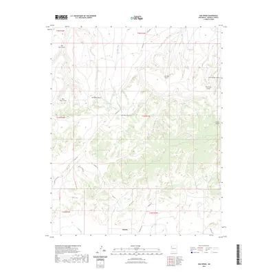
2023 Map of Oak Spring
USGS Topo · Published 2023About this map
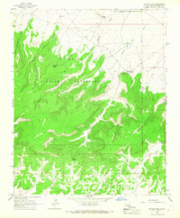
Pinedale sits at the southern edge of this high-altitude landscape, where the Puerco River cuts across the lower terrain of McKinley County. The region is defined by a dense network of canyons and washes that drain the surrounding highlands, including the prominent Red Mesa Canyon and Black Mesa Canyon to the northwest. These geological features influence the local road network, with routes like Chestnut Rd and Rainbow Trl Rd navigating the complex topography between the mesas.
Find a feature on this map
30 named features on this map. Tap any name to fly to it.
Don’t see what you’re looking for? This feature index may not catch every label — zoom into the map to look around manually.
Map Details
Editions of this 2023 Oak Spring Map
This is the sole edition of this map. No revisions or reprints were ever made.
Other maps of this area

1886 · Wingate
USGS Topo · 1:250,000

1892 · Wingate
USGS Topo · 1:250,000

1954 · Gallup
USGS Topo · 1:250,000

1958 · Gallup
USGS Topo · 1:250,000

1959 · Gallup
USGS Topo · 1:250,000

1962 · Gallup
USGS Topo · 1:250,000
1963 · Mariano Lake
USGS Topo · 1:24,000
1963 · Pinedale
USGS Topo · 1:24,000
1963 · Church Rock
USGS Topo · 1:24,000
1963 · Dalton Pass
USGS Topo · 1:24,000