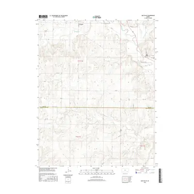
2015 Map of Oak Valley
USGS Topo · Published 2015About this map
Longton and Oak Valley anchor this southeastern Kansas landscape where the terrain is defined by the winding course of the Elk River and its numerous tributaries. The map details a transition between Elk and Chautauqua counties, marked clearly by the EK/CQ Co Line Rd. Rural history is preserved through several small burial grounds, including the West Liberty Cem and Crum Cem, which sit among the rolling drainage basins of Salt Creek and Bloody Run. The placement of these cemeteries and the grid of section roads like Alfalfa and Pasture Rd reflect the enduring agricultural character of the region. This 2015 survey provides a modern view of a classic prairie river system, showing the drainage patterns of Hickory Cr and Bachelor Cr as they feed into the primary river valley near the town of Oak Valley.
Find a feature on this map
44 named features on this map. Tap any name to fly to it.
Don’t see what you’re looking for? This feature index may not catch every label — zoom into the map to look around manually.
Map Details
Editions of this 2015 Oak Valley Map
This is the sole edition of this map. No revisions or reprints were ever made.
Other maps of this area

1885 · Sedan
USGS Topo · 1:125,000

1886 · Independence
USGS Topo · 1:125,000

1889 · Sedan
USGS Topo · 1:125,000

1894 · Independence
USGS Topo · 1:125,000

1905 · Independence
USGS Topo · 1:125,000

1947 · Joplin
USGS Topo · 1:250,000

1949 · Joplin
USGS Topo · 1:250,000

1954 · Joplin
USGS Topo · 1:250,000

1955 · Wichita
USGS Topo · 1:250,000

1958 · Wichita
USGS Topo · 1:250,000