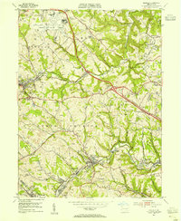
1953 Map of Oakdale
USGS Topo · Published 1955About this map
The Greater Pittsburgh Airport and its sprawling runways dominate the northern landscape of this mid-century survey, surrounded by the transitioning industrial terrain of western Allegheny County. While the airport represents a new era of infrastructure, the surrounding hills are heavily marked by extensive strip mining operations and local coal history, seen in settlements like Cliff Mine and Noblestown. The corridor between Imperial and Oakdale is a dense network of early transportation routes, including the Montour RR and the Pennsylvania RR, which served the region's extraction industries and small mill towns.
Find a feature on this map
63 named features on this map. Tap any name to fly to it.
Don’t see what you’re looking for? This feature index may not catch every label — zoom into the map to look around manually.
Map Details
Editions of this 1953 Oakdale Map
This is the sole edition of this map. No revisions or reprints were ever made.
Other maps of this area

1901 · Beaver
USGS Topo · 1:62,500

1904 · Beaver
USGS Topo · 1:62,500

1904 · Carnegie
USGS Topo · 1:62,500

1904 · Burgettstown
USGS Topo · 1:62,500

1906 · Burgettstown
USGS Topo · 1:62,500

1906 · Carnegie
USGS Topo · 1:62,500

1906 · Sewickley
USGS Topo · 1:62,500

1908 · Sewickley
USGS Topo · 1:62,500

1908 · Carnegie
USGS Topo · 1:62,500

1948 · Pittsburgh West
USGS Topo · 1:24,000
Featured Places
- Moon Township, PA
- Robinson Township, PA
- Sturgeon, North Fayette Township
- Oakdale, PA
- Rennerdale, Collier Township