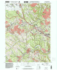
1993 Map of Oakdale
USGS Topo · Published 1999About this map
The Greater Pittsburgh International Airport dominates the northwestern corner of this Allegheny County landscape, illustrating the regional transition toward modern transportation infrastructure. Beneath the flight paths, the terrain is deeply etched by Robinson Run and Montour Run, where older industrial and community patterns remain visible. The legacy of resource extraction is evident in the naming of Cliff Mine and Beechcliff, while several clusters of oil wells are noted near Union United Oil Wells Ch. Multiple military reservations are scattered throughout the townships, including a prominent NORAD Joint Manual Direction Center south of Oakdale. This 1993 study captures the area's complex character, balancing suburban growth in Findlay and Moon townships with the preservation of Settlers Cabin County Park and the older residential grids of Noblestown and Rennerdale.
Find a feature on this map
60 named features on this map. Tap any name to fly to it.
Don’t see what you’re looking for? This feature index may not catch every label — zoom into the map to look around manually.
Map Details
Editions of this 1993 Oakdale Map
This is the sole edition of this map. No revisions or reprints were ever made.
Other maps of this area

1901 · Beaver
USGS Topo · 1:62,500

1904 · Beaver
USGS Topo · 1:62,500

1904 · Carnegie
USGS Topo · 1:62,500

1904 · Burgettstown
USGS Topo · 1:62,500

1906 · Burgettstown
USGS Topo · 1:62,500

1906 · Carnegie
USGS Topo · 1:62,500

1906 · Sewickley
USGS Topo · 1:62,500

1908 · Sewickley
USGS Topo · 1:62,500

1908 · Carnegie
USGS Topo · 1:62,500

1948 · Pittsburgh West
USGS Topo · 1:24,000
Featured Places
- Moon Township, PA
- Robinson Township, PA
- Sturgeon, North Fayette Township
- Oakdale, PA
- Rennerdale, Collier Township